


Various positioning and navigation systems have been developed to determine the location on the ground concerning a coordinate system. All these systems have been developed for the military. Their main task is to target weapons and use so-called smart munitions; the second goal is navigation and orientation in spatial coordinates for the civilian sector.
Navigation systems are under the control of the military. Building and maintaining these systems is very expensive, so to cover some of the costs, the navigation system has been opened up for civilian use.
At least 24 operational satellites are needed to operate a navigation system and cover the entire planet. It is possible to create a navigation system that would cover only part of the territory (it is cheaper); this is the way India is going, creating a regional navigation system.
What navigation systems are available
As I said before, the construction and operation of satellite navigation systems are expensive, so very few navigation systems use satellites. That is why you can see these navigation systems on your phone or car navigation system.
- GPS – operated by the U.S. government
- Glonass – operated by Russian Ministry of Defense
- Beidou – operated by the Chinese government
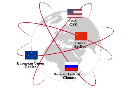
- Galileo – The European navigation system is created as an alternative to GPS for European countries at the expense of the European Union and investors.
- IRNSS – The Indian Regional Navigation System is designed for navigation in India and the region within 1,500 km (930 miles) of India’s borders.
- QZSS – Japanese regional navigation system.
How GPS and other satellite navigation systems work
The basis of any satellite navigation system is time. It is time that is the basis for all positioning calculations. That is why several accurate clocks (we used to call such clocks atomic clocks) are on board a satellite. As a rule, there are two main clocks and two backup clocks.
The receiver in your phone or car navigation device receives the signal from the satellite.
Because the signal being transmitted transmits the current time (the atomic clock on the satellite) as well as the coordinates of the satellite (the satellite’s location in geostationary orbit), The navigation software calculates the time in which the receiver has received the satellite signal since it sent the satellite and calculated the distance from the navigator or smartphone to the satellite.
With a signal from two satellites, you can calculate coordinates, but you can’t determine elevation; with a signal from a third satellite, you can calculate your exact location. Some systems use the center of the Earth as the third satellite as the reference point, but the error will be tens of meters (feet) in this case.
The more satellites that receive the signal, the more accurately we can locate the receiver. Also, the more accurate the location, the longer the receiver takes to work, and the error decreases with each subsequent calculation.
The navigation software in your phone or car overlays your location on the map according to the coordinates calculated by your phone. Or on the game map if geolocation is used in the game. This is how the phone or car determines its location.
GPS vs. Galileo vs. Glonass vs. Beidou
Depending on the country, different navigation systems may be used. GPS is the most widely used because it was the first system. Owners of other navigation systems promote their systems using the law. For example, if a device uses geo-positioning, it must necessarily support the national system. For example, all smartphones and car navigation systems in Russia must support Glonass, and in China, Beidou. But in general, all the systems work on the same principle; they can complement each other to determine the location faster. GPS and Galileo are more promising; Glonass and Beidou are subject to government control.
I turned off the GPS on my phone, but my phone is locating.
You should know that your phone’s GPS is not the only location system. Your phone also has a location system based on signals from base stations. More specifically, based on the signal strength from base stations. Your smartphone estimates signal strength and determines the distance to the base station that your cell phone is working with. The base stations periodically send a request and receive a response from your phone. If your phone receives a request from three base stations, your smartphone’s positioning software determines your phone’s location. But this positioning system is less accurate than satellite systems and doesn’t work well in poor cellular network coverage conditions.


